Sponsored: New UK Fishing Gear Restrictions Mapping Service
23rd November 2021
The Kingfisher team at Seafish launch free interactive mapping service to help fishers navigate commercial fishing gear restrictions in the UK.
In association with The Kingfisher team at Seafish, comes the announcement that they have launched a new fishing restrictions mapping service.
This free service allows fishers to view all UK fishing gear restrictions in one place, with complete coverage of all regulatory authorities. The service has been fully funded by the EMFF and the MMO.
The Kingfisher team created this service following discussions with stakeholders in the industry in relation to the difficulty they were experiencing in sourcing and understanding complex fishing legislation.
Information surrounding the protected areas has previously been spread across multiple websites and information sources, often missing positional data about restriction boundaries. Now, for the first time, they are available in one place and can be accessed – in port or at sea – via an interactive map, data plotters and information download. The restrictions can also be shared via WhatsApp, social media and email.
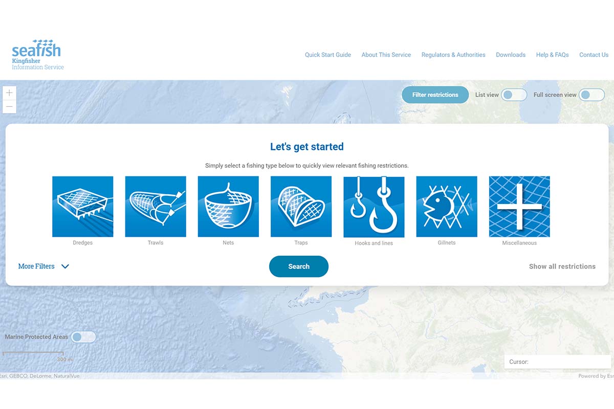
The service lets you access information by gear type…
Eleanor Michie, GIS analyst at Seafish and lead on the fishing gear restrictions mapping project, said: “We know that fishers are currently facing difficulty in finding, interpreting and plotting the commercial fishing restrictions in UK waters. The new mapping system aims to improve understanding and create a platform which can be used with confidence. It provides fishers with an answer to the question: ‘Am I allowed to fish here now?’
“In making this information easily available to fishers, we hope to increase awareness of prohibited and permissible fishing operations and promote compliance with regulations and sustainable fishing practices.
“In order to ensure the system meets industry standards and is kept up to date, all gear restrictions have been categorised according to the Food and Agriculture Organisation (FAO) fishing gear naming system.”
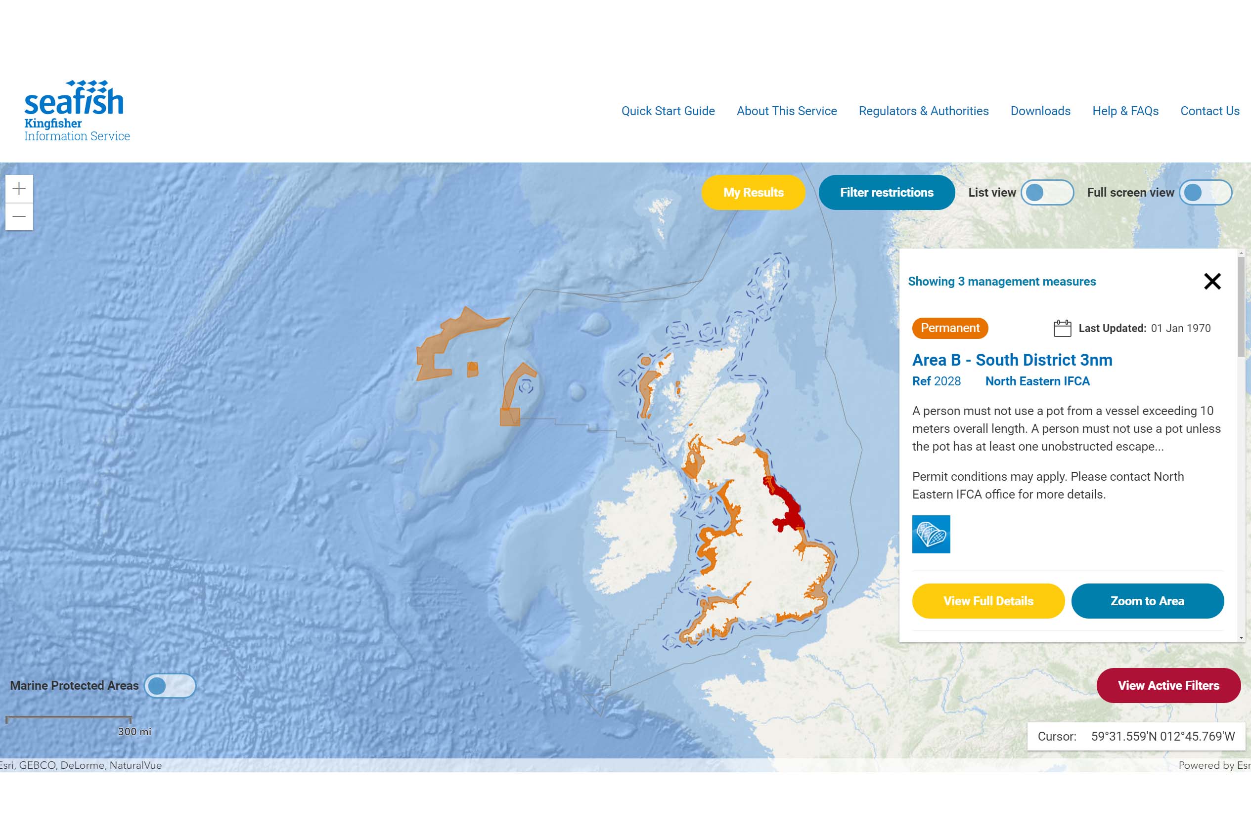
…and view accurate and up to date information for your exact position while at sea.
Dale Rodmell, assistant chief executive at the NFFO, said: “This project brings transparency to the regulations, to know where they apply, and make what is a rapidly growing and complex set of rules easier to follow.
“If you are going out in your car, you need to know what the rules of the road are at any point during the journey, and it’s the same with fishing. On the road, this is done with road signs, but there is no equivalent for sea fishing, and this project helps to fill that gap.
“It will make it much easier, especially when at sea, to know what rules apply in a particular place, and helps to ensure no one inadvertently breaks them, which can only be good for the industry.
“It also ensures that the purposes of regulations are realised, and that in turn is a sign of sound fisheries governance.”
The Kingfisher team will also distribute the data on USB sticks via fishing associations towards the end of the year, so that fishers can easily add it to their plotters.
To find out more, click here or contact: Eleanor.Michie@seafish.co.uk